![99745fd6-afc8-495e-a1a1-c5fa6c1501aa.png]](https://resources.spectotechnology.com/hs-fs/hubfs/99745fd6-afc8-495e-a1a1-c5fa6c1501aa.png?width=300&height=113&name=99745fd6-afc8-495e-a1a1-c5fa6c1501aa.png)
- Create a Project in GeoExplorer
- Configure the GeoExplorer Project
- Setup the Total Station Device
- Configure Modem
- Add and Configure Total Station in GeoExplorer
- Add Monitoring and Control Points
- Create an Initial Calibration
- Create Automated Calibration
- Set Schedules, Baselines, and Exports
This guide uses a Topcon MS05AXII/MS1AXII total station
1. Create a Project In GeoExplorer
Prior to setup, the GeoExplorer Server Administrator must create a user group that includes the account responsible for the AMTS configuration.
a. Navigate to: Admin-> Projects -> Add
b. Enter Project Name and select "Save".
c. Sign out and sign back in to refresh the project permission
Steps to Create a User Group (Most customers will need to reach out for Specto Support to complete this step):
a. Navigate to: Admin-> User Groups -> Add
b. General: Enter Name, Select Project
c. Users: Select Users
d. Permissions: (Typical Setup)
- General
- Management
- Mapping
- Alarming
- Reports
- Measurements
- Total Stations
- Weather Stations
e. Click Add/Save to complete the group setup
2. Configure the GeoExplorer Project
a. Navigate to: Admin->Projects->Project Name
b. General: Set time zone
c. Units:
d. Displacement: Inches
e. Distance: Survey Feet
f. Local Coordinate: Survey Feet
3. Setup the Total Station Device
a. Power on the total station - Press the blue button located between the knobs on the side of the total station (19 in figure)-png-png.png?width=228&height=311&name=MSAXII%20Power%20Key%20(19)-png-png.png)
b. AMTS Leveling: Ensure the AMTS unit is level
-
-
- Click the "_|_" icon on the right side menu to bring up the digital bubble screen.
- If the tilt screen is interrupted, temporarily disconnect the serial cable from the modem to prevent communication conflicts during leveling.
-
- c. Orientation and Coordinates: Set the total station orientation and coordinates. (This will be used to streamline the GeoExplorer setup and does not directly affect coordinates in GeoExplorer.
-
- Click "Menu" (exit out of "Basic observation" if needed) > "1.Coord." Start from the first step, "1. Occupy setup".
- Enter the northing, easting, and height in feet that you wish to use for the total station coordinates in GeoExplorer. If you have manual survey coordinates for the total station, use them. Otherwise, use arbitrary coordinates.
(ex. Occ.North: 1000, Occ.East:5000, Occ.Elev: 0) . Click OK - Enter the Azimuth. You can find the actual angle of your initial control point with a compass and enter that. Or aim your total station at the initial control point. Click SRCH (search). After it locates the prism, enter the known angle or leave 0. Click OK.
-
-
-
- Click MEAS (measure). The AMTS will shoot the prism and return the coordinates. Take a picture of the screen or write the coordinates down.

- Click MEAS (measure). The AMTS will shoot the prism and return the coordinates. Take a picture of the screen or write the coordinates down.
-
4. Configure Modem
a. Modems are shipped pre-configured, but if you're using a modem from another system, the following steps should be taken:
-
-
- Contact us to get a modem template
- Log in to ACEmanager by entering the IP address and :9191
(ex. 192.555.0.1:9191) into your address bar - Click the Serial or Dual Serial tab
- Configure RS232 Port: 9600,8N1
- Flow Control: None
- Click PAD on the sidebar
- Device Port: 12345
-

5. Add and Configure Total Station in GeoExplorer
a. Systems-> search for "Total Station" and click (+) Add
b. Name the total station and select Installation type Live
c. Use Fixed Position to start. We will later change this to Helmerts.
d. Under the Live tab
-
-
- Device type is "Topcon MS AXII"
- Connection Type is TCP Client
- The host is the static modem IP address
- Port: 12345 (matching modem)

-
6. Add Monitoring and Control Points
- a. Hover over the Total Station (on the right of the screen), click
 the icon, select Live Control
b. Request Manual Control
c. Turn on the pointer Laser or Guide Light if desired (choose from the appropriate dropdown menu)
d. Reflector Prescan
-
- This option allows you to select a window of angles to be scanned
- Point the total station to the top left and bottom right of the scan window. Click the target icon to read the angles at each position to establish the search window.
- If you are shooting IR tape, change the Target Type accordingly
- The prescan may catch the same prism multiple times - you can check the coordinates for uniqueness and leave just one entry per point.
- Once the scan is complete, select which readings in the list you want to save or remove & rename
- Once saved, they will be recorded in the Observations list
- If you're using prescan without using the total station to set the window bounds, you may enter them manually. Keep in mind that the vertical angle is measured from zenith, and the view is limited by the handle in the body of the instrument to approximately 20-130 degrees from zenith.

-
- Add Observations -> Add -> Add by pointing
- Add manually by entering known coordinates
- Add Observations -> Add -> Add by typing in angles or coordinates
- After shooting prisms, check that all settings are correct
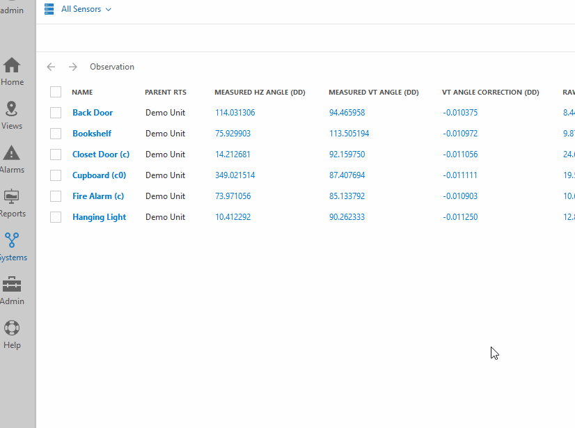
- Systems --> Observation, this brings up a list of all the prisms that have been read
- Select all points Queue confirm that all observations are reading as expected
- Select Edit->
- Measurement-> Target type -> Mini Prism
(If you are using another type, choose accordingly.) - Scheduling -> Measure Both Faces (click until it's On,) Save
- Measurement-> Target type -> Mini Prism
- Select your control points Edit-> Scheduling -> Measurement Priority -> High (Save)

7. Create an Initial Calibration
a. Select Systems -> Total Stations -> Calibrations, this brings up a list of all the calibrations that have been made. For a new project, it should be empty.
-
-
- Compute Calibrations -> Add from current Date/Time
- General - Fixed Position
- Calibration:
- Configuration - Make sure min control points is 1
- Fixed Position - enter the total station coordinates from the middle of step 3
- Control Observations - select the "Observation" (prism) used during manual setup, click the pencil to manually enter the coordinates from the end of step 3.
- Weather station - Use Standard Atmospheric Corrections - The Weather station can be added later.
- Click Preview. If there's a green check mark under the "Valid" column, click on Replace & Apply.
- Go back to observations (Systems -> Observation). Check the box for all your prisms again, and Queue a measurement for all.
- Now we should have valid coordinates for all the prisms measured. (Calibrations can be reprocessed at any time to repair invalid data, assuming enough good measurements exist)
- Compute Calibrations -> Add from current Date/Time
-
8. Create Automatic Calibration
Hover over the total station name on the right. Click on the cog icon
- General - Switch to Helmerts unless your total station is likely to be the most stable thing in your network.
- Calibration
- Configuration:
- Instrument Height - don’t use this
- Data Window - This is the time span of data that is used in the computation of the calibration. Using a window 3-4 times the measurement interval is recommended
- Min Control Points is the minimum number of control prisms successfully measured to consider the cycle valid. (typically one to two less than total control points, or a minimum of 3 for Helmerts and 1 for Fixed Position)
- "Horizontal Corrections" set to ON
- "Vertical Corrections" set to OFF, since the tilt sensors in the instrument correct for this
- "Scale Corrections" is set to OFF, since you need many control points for this to be effective. This adjusts the slope distance measurements.
- Configuration:
-
- Fixed position/Helmerts - Make sure your total station coordinates are entered here. Edit your residuals if needed. If you don’t know if you need to do this, leave them as the default
- Control observations - add the remaining control prisms used during manual setup
- Select the control point observation
- Click the pencil to enter its coordinates
- Click on the calendar, then Compute Coordinates to select the measured coordinates from the end of the last step.
- Save
- Weather station - Now you can add a weather station if desired. See the separate guide on GeoExplorer weather station corrections for AMTS.
9. Set Schedules, Baselines, and Exports
-
- Check the settings on each observation to customize its measurement schedule.